Friday, 8 October 2010

Final thoughts, statistics and trivia.


If you have just found this blog for the first time I strongly recommend you read it in date order. Please click this link to be taken to the start of my adventure.

If you would like to make a donation to MacMillan Cancer Support please Click Here.

Gary

Final Thoughts

My end-to-end walk was a wonderful experience that I will never forget, I consider it to have been one of the highlights of my life. It was everything I'd hoped it would be and so much more. The scenery I walked through was amazing and everybody I met was very friendly. Surely there can be no better way to explore this beautiful island.

I'm not going to pretend it was easy, 1008 miles is a long way, but the effort was well worthwhile to fulfil a personal ambition and to help raise money towards the vital services that MacMillan provide. Fortunately I had good luck on my side, I managed to stay almost completely clear of injury and I enjoyed good weather most of the way.

By the time I reached Lands End I'd lost nearly a stone in weight and everybody was telling me how tanned and healthy I looked. I'd never felt fitter in my life and given the chance I'd have happily turned around and walked back the other way. I would like to say a huge 'thank-you' to the many people who helped on my way, and especially to everybody who has made a donation to MacMillan.

If you have enjoyed this blog I would be delighted if you would consider making a small donation to MacMillan Cancer Support as part of my fund raising effort. You can do so easily using my Just Giving page, please click here .

Statistics

Based on 48 days my average daily distance was 21.02 miles. Excluding the 5 rest days the average comes to 23.46 miles walked per day.

I was on the move for 267 hours and 11 minutes.

My average walking speed was 3.77 mph.

On 18 separate days I walked more than a full marathon (26.2 miles).

My highest daily mileage was the 33.90 miles covered on day 22, the lowest was 7.64 miles on day 29.

I walked around 2,017,540 steps (based on my estimated average of 2,000 steps per mile).

Though I didn't know it at the time, the half-way point was passed during day 24 on the A6 in Preston, just north of the city centre.

This is an accurate map of the route I walked, it was created by compiling all the GPS tracks;


Q. How do you know you walked exactly 1,008.77 miles?

A. Easy, I took a sensitive Garmin GPS receiver with me (model eTrex Legend Hcx), it recorded my entire route in fine detail. The GPS tracks for each of the 43 days on which I walked are online for anybody to see, you can view them if you click here .

Trivia

My daily blog entries were typed-out each evening on my Apple iPhone 3s smartphone, usually in a quiet corner of a pub over dinner and a couple of pints. I've never gone back and editted anything, they all record my thoughts as recorded on the day to which they refer.

On day one I stopped at a supermarket in Wick and bought a multi-pack of Mars Bars. They went into my backpack, kept ready to give me an energy boost at times of tiredness. Four of the bars had been eaten by the time I left Scotland. The fifth one went all the way, it was still in my pack when I reached Lands End forty seven days later.

I only used one proper map on the entire walk (a map of the West Highland Way I purchased at Fort William). I posted it home just five days after it was bought. The rest of the time I relied solely on my smartphone for navigation.

On the morning of day nine I came under attack by a swarm of midges as I packed away my tent. In my hurry to get away I accidentally left without a pole that was part of the frame. I made do without it until day sixteen when I replaced it with a piece of bamboo bought from a garden centre.

Three weeks before my walk was due to start I took my children on holiday to Blackpool. While there they gave a small model of my favourite Toy Story character, a three-eyed alien. The next day, having completely forgotten about the alien which was in my pocket, I entered and won a poker tournament in the local casino. As a result I decided the alien was a lucky charm and that it should go on the walk too. I fixed it onto the left shoulder strap of my rucksack as soon as we got home. It survived the flights to Wick in the hold of the aircraft, then all forty eight days of walking between John o'Groats and Lands End. Coincidentally or not, my good luck lasted all that time too.

In the run up to my end-to-end I'd already lost 6 lbs in weight as a result of practise walks. Before setting off for John o'Groats I weighed-in at 13st 5lbs (85KG). By the time I returned home my weight had fallen a further 11lbs to 12st 8lbs (80KG).

During the walk I took more than 900 photographs, only a small selection can be featured on this blog. If you would like to see more click here .
The lucky alien, still on the shoulder strap
of my rucksack after 1008.77 miles

Wednesday, 6 October 2010

Day 48 Newlyn to Lands End

Wednesday 6th October 2010

After nearly seven weeks away from home I've completely gone off the full English breakfast typically offered in hotels and guesthouses, so I chose to start the final day with a good old fashioned bowl of porridge. The weather decided to be very kind to me again, heavy rain fell overnight but I drew the curtains in the morning to be greeted by a perfect blue sky. After we checked out of our hotel Lea drove me back to Newlyn and I hit the road for the last time.

Near Lamorna, as I passed uphill through a wood, I completed my 1,000th mile. I'd wanted to break the 1,000 mile barrier on this walk so that was a satisfying moment for me. Without all the meandering along the Cornish coast on Sunday and Monday I probably wouldn't have made it without going around the block a few times somewhere. A bit further on, right next to the road near St.Buryan, I came across the fascinating Tregiffian burial chamber, a chambered Neolithic tomb thought to be 4,000 to 5,000 years old. There are many standing stones and other ancient monuments in this area. At Treen after descending into a valley I walked up the last incline of my journey. By now I could see the sea on the horizon in every direction except behind me. When I saw the Lands End Coastguards Rescue Team building I knew the end was very close.

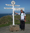
Where the B3315 meets the A30 I caught my first glimpse of the Lands End complex. My daytime refreshment of choice during this walk has been a bottle of isotonic sports drink, but I fancied something different today. Instead of walking straight down the road I first headed a little north into Sennen where I enjoyed a pint of fine Cornish ale at The First And Last Inn. It went down a treat, then it was time for my big moment. The easy downhill mile from the pub to Lands End seemed to go by in no time at all. Lea and John from Dairy Crest were waiting at the finish line to cheer me over. My joy at successfully completing this journey overcame me for a while, I don't mind admitting I was in floods of tears as I crossed the line. After composing myself I carried on through the complex to the famous sign and had the obligatory photo taken.

We stayed at Lands End for a couple of hours savouring the atmosphere. I signed the guestbook for end-to-enders in the hotel reception and found myself being congratulated by many people. A crowd were waiting for a group of cyclists who were due to finish their ride from from John o'Groats, we waited with them and watched as they finished. Unsurprisingly the cyclists had also suffered a last minute 'delay' at the pub in Sennen. Lea and John had both presented me with a bottle of champagne, I'd happily finished one of them by the time we left. The enormity of what I've done began to dawn on me as we drove home. It took ages just to get out of Cornwall using the dual carriageways I'd avoided like the plague while walking, and that was just a small fraction of the distance I'd covered during my incredible journey over last six weeks and six days.

GPS track click here

Mileage today; 11.57 miles, walking time 2 hrs 55 mins, average walking speed 4.0 mph

Weather; Sunny, breezy, max 18C

Cumulative mileage; 1,008.77 miles


The Neolithic Tregiffian burial chamber


The Famous First & Last Inn at Sennen


The End!

Tuesday, 5 October 2010

Day 47 Camborne to Newlyn

Tuesday 5th October 2010

My morning started today with a wonderful reception from all the team at the Milk & More depot in Camborne. Manager John, his assistant Jackie and all the other staff were a very friendly bunch and their good humour had me in stitches. After we'd all posed for pictures and while I was preparing to leave John handed me an envelope, it contained a good luck card and a whopping £150 donation for MacMillan. The donation was the total raised by a whip-round among the staff, it was a wonderful surprise and I'd like to thank everybody who contributed at Camborne for their amazing generosity.

Camborne and the surrounding areas used to be the richest place in the world for mining, there are still many ruins of chimney stacks and engine houses. You can't help wondering how it all must have looked in its hey day 150 years ago. After leaving town I headed southwest through the undulating countryside using quiet single-track lanes. There wasnt much too see, in part due to the tall hedgerows that are typical around here. At Barripper there is a cannon in the middle of the village, it was retrieved from the wreck of HMS Association that sunk off the Scilly Isles in 1707.

Giving my legs a rest wasn't the only reason I hadn't headed back to continue along the North Cornwall coast. When I arrived on the other side of the peninsula at Marazion I was treated to great views of St.Michael's Mount. This spectacular tidal island with its impressive castle is only connected to the mainland by a causeway that's exposed at low tide. I bought lunch in town and relaxed on a bench for an hour watching small boats going to and fro in the sunshine. From Marazion I continued west around Mounts Bay. The path goes past Penzance railway station. This really is the end of the line, being both the most southerly and the most westerly railway station in England. As I walked along the promenade at Penzance I was sprayed a few times with seawater being thrown up by waves crashing on the seawall, it was quite refreshing in the afternoon sun. While here I noticed a road sign directing traffic to Lands End for the first time.

At Newlyn I passed the harbour which was packed with fishing vessels. Fishing is clearly big business here and there were many shops selling fresh catches. From there I climbed up through some steep narrow lanes to the B3315 which heads out of town to the west. That will be my final route to Lands End, I've left myself around 10 miles to do tomorrow.

GPS track click here

Mileage today 18.83 miles, walking time 4 hrs 54 mins, average walking speed 3.8 mph

Weather; Overcast in the morning, sunny in the afternoon, breezy, max 18C


Cumulative mileage; 997.20 miles


The cannon at Barripper

St.Michaels Mount in Mounts Bay


The fishing fleet in Newlyn harbour with Penzance in the background

Monday, 4 October 2010

Day 46 Newquay to Camborne

Monday 4th October 2010

As Lea is now staying with me in Cornwall I had another opportunity today to walk without carrying most of my kit. However, I've carried my full pack all this way and got on just fine, I'm used to the weight and I don't want to risk changing anything now. I've decided I'll carry all my gear to the very end whether I need it or not, it's as much a part of the walk as me. Lea brought our spare camera to replace the one I broke yesterday, fortunately all the 100+ shots were still safely stored on the memory card.

Today would turn out to be a hard day, but with great weather and more spectacular coastline to enjoy. After finding my way out of Newquay I walked for a mile or so along the soft sand on the western side of the Gannel Estuary. After climbing up onto the coast path the marvelous views soon carried on from where they left off yesterday. First was Crantock Bay, then I came across a couple of beautiful but deserted small beaches hidden away between headlands. Once again the coast path is not the quickest way to get from A to B, each beach or valley you come to involves making detours, descents and ascents to move onto the next headland. Holywell was the next scenic beach with its massive sand dunes and surfers in the waves.

After Holywell you start walking alongside MOD land. Among the warning signs I saw as I passed strange military equipment were those bluntly saying 'Warning - troops in training, stay away from miltary debris, it may explode and kill you'. Maybe it's not only the roads that are danger to walkers after all. Soon after I saw the first old mine shafts of the day, uncapped but fenced off. Penhale Sands then came into view, luckily the tide was out and I was able to walk along the two or three miles of spectacular beach here, the firm sand offered the easiest walking of the day. At the other end I came to the pretty town of Perranporth. I took my only break of any length here and treated myself to a Cornish ice cream after finishing the rest of my lunch. By the time I continued on my way I noticed the Penhale Sands had been covered by the incoming tide, if I'd arrived an hour later I'd have had to go another way.

After Perranporth the path starts to get harder and you really know you're coming into the tin mining area. There are slag heaps and old mineworkings everywhere. Most of the mineshafts are vertical with grills over the top, but some are horizontal and you can still just walk in. I stopped and peered into one, it looked damp and very cramped, theres no way I could have gone in at six foot tall without stooping down. Around the St. Agnes area there are still many ruins of old mine buildings to be seen, the best preserved were at Wheal Coates. When I stopped at one of the many viewpoints between Perranporth and St. Agnes to take a picture I found myself in conversation with a friendly couple from Yorkshire who were walking the other way, by the time we parted they had very kindly given me a donation for MacMillan.

As the afternoon wore on the coast path started to remind me of the mountainous parts of the West Highland Way. The climbs were getting very harsh and you have to go carefully on the loose rocky surfaces. As in Scotland though all the hard work is very well rewarded with more spectacular views at every turn. Between Porthtowan and Portreath alongside more MOD land there were some very steep sections going down into and up out of valleys where you have to clamber up and down rugged steps carved into the hillsides.

After 24 miles of hard leg work and feasting my eyes on the superb scenery I left the coast path at Portreath. From there I walked three miles inland to the Milk & More depot at Camborne. It was shut that late in the day, but I will return there tomorrow morning and resume walking after meeting the staff. I'm still considering my route options for final two days, but I intend to arrive at Lands End at lunchtime on Wednesday. My right heel is improving and almost feels back to normal, I have no blisters or other injurys to report. Something pretty awful would have to happen now to stop me making the finish.

GPS track click here

Mileage today; 27.23 miles, walking time 7 hrs 55 mins, average walking speed 3.4 mph

Weather; mainly sunny, becoming overcast in the late afternoon, breezy, max 17C

Cumulative mileage; 978.37 miles
Arriving at Penhale Sands, three miles long and a surfers paradise
Tin mine ruins at Wheal Coates south of St.Agnes

Typical rugged scenery on the North Cornwall coast


Sunday, 3 October 2010

Day 45 Harlyn to Newquay

Sunday 3rd October 2010

Another inch or so of rain fell in Cornwall this morning. Luckily for me it all came down the early hours while I was still tucked-up in bed. I watched the last few rainclouds blow away while I ate my breakfast. Lea had left much earlier, skipping her breakfast, to make sure she would be back in Exmouth in time for work.

The days walking started with a stroll across the sands of Harlyn Bay, the first of several beaches I would tread upon on today, there were already surfers in the water. The coast path then climbed up and took me around Trevose Head. The coast here is rugged but spectacular. I hadn't been walking for long before it became clear that I was in for a day of amazing scenery. There was a stiff wind blowing off the Atlantic, huge waves and white surf were crashing over rocks everywhere. You are left in doubt of the power of the sea, mother nature is the boss in these parts.

The path was unsurprisingly covered by wide puddles in places, slippery and muddy much of the way, but this was a small price to pay for the amazing coastal views. As I headed south the path took me past beautiful coves and cliffs, occasionally dropping down onto golden beaches such as those at Boobys Bay and Treyamon. The South West Coast Path here really is true to it's name, it follows the coast faithfully. You can see, hear and smell the sea at all times. On some national trails earlier in my walk, The Great Glen Way and The Severn Way for example, I found myself walking through places that didn't really fit the title.

At Treyamon the heavy rain of the last 48 hours running off the land had formed a wide and fast river running across the beach. The only way I could see to get across was to take off my boots and socks, roll up my trouser legs and paddle through. That was fun and it worked fine, but unfortunately my camera dropped out of my pocket and into wet sand for a split second while I was pulling off a boot. It wouldn't switch back on afterwards. I'm not worried about the camera, I just hope the pictures from the last few days haven't been lost. The memory card didn't get wet. I swopped to taking pictures on my mobile phone, which wasn't really useful for much else at the time, I hadn't seen any network coverage since leaving Padstow the previous afternoon.

The breathtaking scenes continued as I headed south. The path is hard work, you're always dropping down into steep valleys then climbing back up the other side, but it's well worth the effort. I took my only break of the day at Mawgan Porth where I watched horse riders exercising their mounts on the sand.

The afternoon continued in the same vein as the morning, again and again I found myself stopping to admire spectacular views as Newquay slowly got closer. We all see places like the Cornish coast on TV, but that comes nowhere close to actually being there in the flesh and taking it all in for real. As I arrived in town there were dozens of surfers bobbing up and down in the sea at Newquay's famous beaches waiting for that perfect wave to ride.

Considering the relatively low mileage today had been fairly tough, but highly exhilarating at the same time. I rate the scenery on the South West Coast Path as good as any other I've seen on the walk, The Highlands of Scotland included. Why some walkers choose to pass through Cornwall on the awful A30 dual carriageway when there is so much natural beauty just a few miles away I will never know.

I'm so close to Lands End now I could easily hit the road tomorrow and get this over and done with in a couple of days. I've decided I'd prefer to spread the remaining miles over three days though. This means I won't have to hurry and can enjoy more of the coast path, also it will leave me an easy final day on Wednesday and plenty of time that afternoon to savour the climax of this walk.

GPS track click here

Mileage today; 17.82 miles, walking time 5 hrs 11 mins, average walking speed 3.4 mph

Weather; sunny spells, windy, max 18C

Cumulative mileage; 951.14 miles

Trevose Head Lighthouse, built in 1847


The coast path was a bit tricky in places after the recent heavy rain


Typical scenery north of Newquay


Saturday, 2 October 2010

Day 44 Bodmin to Harlyn

Saturday 2nd October 2010

It was with great relief that I awoke to this mornings sunny start. Just about everything in my pack had got damp to a certain extent during yesterdays deluge. When it rains that hard and you're out walking for hours it doesn't matter how good your waterproof stuff is, you will get wet, water will get in your boots, the banknotes in your wallet will get wet, if you're camping you will realise that even your sleeping bag got wet.

Heading west from Bodmin offered three choices of route to Wadebridge. I ruled out the Camel Trail, a path along a disused rail track, as I was sure this section would be very muddy. The A-roads around here are busy, narrow and twisting, they don't cater for pedestrians at all. Having survived this far I'd much rather finish my journey on foot than in a hearse, so I went for the third option, those country lanes again.

The lanes were very quiet indeed, as I followed the River Camel on it's southern side I saw as many people on horseback as driving vehicles. There were vineyards to be seen in the valley here. The hills were harsh again, in Bishops Wood I carefully made my way down a 28% descent, the steepest signposted hill I've come across in all 44 days.

By midday I'd reached Wadebridge. I stopped there and bought myself a full English breakfast in a pub. As I finished my meal I was delighted to get a call from my partner Lea telling me that she was also in town. Having had a shorter than usual day at work she'd driven all the way down from Exmouth to surprise me.

When we left the pub Lea drove on ahead to Padstow while I made my way there on the Camel Trail. It was superb here, a good hard surface taking it along the Camel estuary with spectacular views all the way. The trail was very busy with walkers and cyclists enjoying the pleasant day. The bicycle hire shops at each end were doing good business. I wasn't surprised, I don't think I've ever seen a better example of an old railway line being converted for leisure use.

Padstow was a wonderful little place. The harbour area is full of charm and character, I was very glad I'd decided to go out of my way a little and include it on my route. There were plenty of people in town and Rick Stein's famous fish n' chip shop had a queue out of the door. We spent a couple of hours sat by the harbour people watching and savouring the atmosphere.

We've decided to spend the night three miles further down the coast at Harlyn. I walked here from Padstow along the road. For the first time in this journey I find myself face to face with the Atlantic Ocean. This is real surfers territory, as I arrived there were dozens of them in the sea at Harlyn Bay.

Tomorrow I will make my to Newquay, the UK's surfing capital, via the South West Coast Path.

GPS track click here

Mileage today; 17.97 miles, walking time 4 hrs 44 mins, average walking speed 3.8 mph

Weather; bright spells, max 17C

Cumulative mileage; 933.32 miles
The very steep hill in Bishops Wood
The Camel Trail crosses this old railway bridge between Wadebridge and Padstow


Padstow Harbour


Friday, 1 October 2010

Day 43 Tideford to Bodmin

Friday 1st October 2010

I'd been hoping the weather forecast for today would be incorrect, unfortunately it wasn't. The predicted rain had been lashing down all night and I stepped out of the B&B wearing the full set of waterproofs. For the third day in a row most of my day would be spent heading west on narrow country lanes, though this time it would be in the sort of conditions I haven't seen since I went over the summit of Shap Fell.

To begin my best route was north of the A38, I passed though small villages with typical Cornish names like Doddycross and Menheniot. Liskeard was the only town of any size on my route today. It was only a third of the way to Bodmin and I don't usually like to take a break that early, but considering the foul weather I took the chance to get a cup of tea and a slice of cake. I didn't have the stomach for a proper lunch that early having had the full works for breakfast.

The Ryder Cup teams, playing their match not a million miles away, might have decided to abandon play for the day, but that was never an option for me. Wave after wave of heavy rain blew across as I continued on my way, by now to the south of the A38 after Liskeard. Apart from half an hour on the A390 I managed to stick to quiet country lanes as far as the outskirts of Bodmin. It was fairly hilly going again, some of the lanes looked more like rivers than roads, but at least I was away from the traffic.

As I passed through the centre of Bodmin on my way to the campsite the rain finally ceased. All the hotels and B&Bs I saw in town had signs up saying they had vacancies, I have to admit I was very tempted to wimp out of the camping and pay for a night in the warm and dry, but the sun began to shine just in time for the campsite to win the battle of the scruples and save me a few quid.

Tomorrow I will walk to Padstow on the North Cornwall coast. It had been my intention to make my way from there to Lands End using the scenic coast path. After today's rain all the off-road paths may have turned into quagmires, so it could be that I'll have to reconsider that plan.

GPS track click here

Mileage today; 23.41 miles, walking time 5 hrs 54 mins, average walking speed 4.0 mph

Weather; very wet, windy, max 17C

Cumulative mileage; 915.35 miles


You often come across old Celtic crosses in Cornwall

Menheniot on a wet day

I saw this old mile marker by the roadside

Thursday, 30 September 2010

Day 42 Modbury to Tideford

Thursday 30th September 2010

After leaving California Cross in the early mist I continued my journey westwards through the Devon countryside. The narrow lanes in this area were almost completely traffic-free, there was often half an hour or more between vehicles. Once again the hills were hard work, one long steep stretch heading out of Ermington was possibly the toughest climb I've come across since I came into England.

My walk started in the summer, but it's very clear by now that I've walked my way into autumn. It's not only the deteriorating weather and much earlier sunsets, the trees are changing colour, leaves are beginning to fall and increasingly often I'm finding myself treading on horse-chestnuts, acorns and the like.

With 10 miles or so covered I crossed the A38 on a bridge, found myself on busy roads again and came into Plympton. With rain falling I took the chance to get in the dry and had my lunch in a cafe. Not much further on I dropped into Plymouth's Milk & More depot, it's handily placed for me to the north of the city meaning I could avoid the central areas. While there I enjoyed a very warm welcome from the management team of Nick and Joe as well as product controller Dave, office girl Marie and many other friendly staff.

From the depot I skirted around the northern suburbs of Plymouth until the Tamar Bridge suddenly came into view at St.Budeaux. Another of Brunel's pioneering Victorian bridges takes the railway across the River Tamar right next to the road bridge. The Tamar marks the border between Devon and Cornwall, when I crossed it I entered the final county of this amazing journey. The bridge takes you right into Saltash, I stopped there, found the local bakery and treated myself to a Cornish pasty. All us Devonians know that the pasty was actually invented in Devon by monks in 1105, but the Cornish have perfected them in modern times and it seemed an apt way to mark the moment.

Through Devon I'd managed to avoid walking along the obnoxious A38, the nearest thing to a motorway in these parts. Unfortunately it was unavoidable for a couple of miles west of Saltash this afternoon, but I could make my final approach to Tideford on country lanes. As I made my down the last steep hill of the day, a harsh 1 in 4, my thighs let me know they'd had their best workout in a long time. After walking this far if I come across anything particularly steep I'd rather be going up than going down.

I've entered Cornwall free of blisters, my slightly sore and swollen achilles heel remains a concern, but it's giving me no real trouble. Tomorrow I will avoid the treacherous A38 and make my way to Bodmin via rural lanes.

GPS track click here

Mileage today; 26.11 miles, walking time 6 hrs 39 mins, average walking speed 3.9 mph

Weather; early mist, then mainly overcast with some bright spells and some light showers

Cumulative mileage; 891.94 miles


A crooked church spire in Ermington


Walking under the A38 at Plymouth (much preferable to walking on it!)

Arriving at the Tamar Bridge, Brunels's railway bridge is to the left

Wednesday, 29 September 2010

Day 41 Maidencombe to Modbury

Wednesday 29th September

My first task this morning was to finish the nasty stretch of road between Maidencombe and Torquay. Much like yesterday it had to be walked in murky weather. It wasn't too long before I reached the outskirts of Torquay. I made my way to the Milk & More depot where I was greeted by Tim and Dave.

After passing rows of Fawlty Towers type hotels I had a quick look around historic Torre Abbey before emerging on Torquay seafront. There might be palm trees everywhere but the English Riviera didn't look particularly impressive in the rain. I made my way along the front to Paignton with it's colourful beach huts and pier. The prices advertised by the B&Bs here were the lowest I'd seen anywhere in the whole country.

From Paignton I headed west and made my way inland. Devon is quite a hilly county, if you're passing through on foot steep climbs are are unavoidable and I soon had a few typical examples to tackle. By now though, weeks after conquering the Highlands, I can honestly say I'm not really troubled by hills. In fact after making my way through most of England on mainly flat routes I now quite enjoy a few undulations for the variety. I stayed off the main roads and made my way to Totnes using quiet rural lanes. Totnes would be the only town on my route after leaving the coast so I stopped there for lunch.

By mid-afternoon the intermittent rain had stopped and was replaced by pleasant sunshine. I continued west along more deserted hilly lanes and was treated to many fine views of the Devon countryside, with the peaks of Dartmoor always visible on the horizon. I could see the unmistakeable rock formations at Haytor which I walked to in training a couple of months ago. There were some pretty villages and hamlets on my route including Harburtonford.

Soon after crossing (yet another) River Avon at Garra Bridge I reached the California Cross Campsite 3 miles east of Modbury where I'm stopping tonight. My sore heel is still tender, but it didn't hinder me again today. My worries about it are easing a bit now that it's coped with two days of walking without either worsening or causing any significant discomfort.

After another ten miles or so of making my way along country lanes tomorrow I will pass through the northern parts of Plymouth and visit the local Milk & More depot. When I cross the Tamar Bridge in the afternoon I will enter Cornwall, the last county of my walk. I've booked a B&B a few miles west of Saltash. If everything goes to plan this will all be over in a week.

GPS track click here

Mileage today; 23.12 miles, walking time 5 hrs 55 mins, average speed 3.9 mph

Weather; intermittent light rain until mid-afternoon, then sunny spells, max 17C

Cumulative mileage; 865.83 miles


Ruins and palm trees at Torre Abbey, Torquay 

Paignton Pier

Harburtonford

Tuesday, 28 September 2010

Day 40 Exeter to Maidencombe

Tuesday 28th September 2010

The rest day in my own home on Monday had been the best thing imaginable at this stage of the walk. One thing had played on my mind though as I took my day off, my right achilles heel has become a little sore and stiff. I decided to walk as planned today and see how it goes, I'm also planning to redcuce my average daily mileage from here to the finish to try and avoid making it worse.

Arriving back at the Milk & More depot in Exeter this morning was great fun, everybody gave me a wonderful reception. Seeing all my workmates for the first time in ages was a real treat. A big good luck message had been fixed to the side of my milkfloat. The best surprise of all was to find that no less than three people were going to walk with me. Marcus, who maintains the Milk & More fleet went to great lengths to spare a couple of hours despite being snowed under with work. Product controller Steve, who has completed many long distance charity walks in the past, and office girl Sally had both volunteered to do the whole day.

After posing for photos we left the depot in pleasant weather. After three miles of road walking we joined the towpath of the Exeter Ship Canal and headed south. We passed under the southern end of the M5, 11 days ago I walked under the northern end at West Bromwich. As expected the canal was ideal for walking and we caught plenty of glimpses of wildlife. The canal empties into the Exe Estuary at Turf Lock, from there we continued along the Exe Estuary Trail.

Marcus had been a great walking companion, but he had to leave us when we reached Powderham. As we went along the estuary by Powderham Castle we saw a herd of deer and stags, a woodpecker and a crane. Unfortunately drizzle started to fall by the time we reached Starcross, light rain and drizzle then continued for the rest of the day. Between Starcross, only a mile across the estuary from my home in Exmouth, and Dawlish Warren we had to walk on roads again for a while, but from there on we able to spent most of the day walking along the coast path.

Dawlish was well placed for our lunchbreak, we approached the town walking along the seawall where trains are very exposed to the elements during stormy weather. The line along the coast here is one of Britains most spectacular stretches of rail and it's often seen on TV. Due to the rain we opted to take our rest in a cafe. After leaving Dawlish our previously flat route started to get quite hilly. We were never going to be able to avoid the notorious Devon hills forever and the coast path to Teignmouth gave us our first hard work. We entered Teignmouth on another section of seawall before cutting through town and crossing Shaldon Bridge. We then headed back to the coast path, watching fishermen reeling-in catches as we went.

The hills got taller and steeper south of Shaldon. The views were good when the rain eased, but the constant ups and downs through fields of cows were hard work in the miserable weather. Often the official coast path is hard to follow so we just wandered through fields in what looked like the right direction and hoped for the best. As we came close to Maidencombe we decided to return to the road hoping to find a footpath running alongside it. Unfortunately there was no path and the road here was narrow, bendy and very busy, easily the most unpleasant place we'd found ourselves walking all day.

In bad weather and with the light falling we called it a day just north of Torquay. Sally and Steve had both done a brilliant job and had walked 22 miles each. Sally in particular put in an amazing effort, she had never taken on a such long walk before, but managed to push herself through some tough sections towards the end. I finished feeling relieved that my heel, while still a bit sore, hadn't worsened or really troubled me to any degree. I'd thoroughly enjoyed walking along the estuary and the coast with my workmates. Tomorrow I will resume walking from Maidencombe. After a visit to the Milk & More depot in Torquay I will be making my way through the Devon countryside before stopping at a campsite near Brownston.

I would like to say a big 'thank-you' to all the Exeter Milk & More staff for such a warm welcome today and for their continued support thoughout my walk. Andy, Steve, Marcus and Sally in particular deserve a special mention for putting themselves forward and volunteering to walk with me.

GP:S data click here

Mileage today; 22.08 miles, walking time 7 hrs 6 mins, average walking speed 3.1 mph

Weather; a bright start, then light rain and drizzle, max 17C

Cumulative mileage; 842.71 miles

The four walkers prepare to leave Exeter. Sally, myself, Steve and Marcus.

  
Turf Lock


A view of Teignmouth from the coast path

Sunday, 26 September 2010

Day 38 Taunton to Exeter

Sunday 26th September 2010

After leaving my accomodation I had a mile to walk to get to the Taunton Milk & More depot. Unfortunately it's closed on a Sunday so I didn't have the chance to introduce myself to any local staff. However, my Exeter colleague Andy was already there waiting for me. Andy had bravely volunteered to join me for a tough day of road walking.

As soon as we set off I could see that Andy was an ideal walking partner. He's as tall as me, has an equally long stride and and his natural brisk pace meant he'd have no trouble keeping up. For the second day in a row the weather was perfect, we enjoyed glorious sunshine with a cool breeze that stopped us getting too hot. Taunton was soon behind us as we headed off into the Somerset countryside. For several miles we were overlooked by the Wellington Monument which dominates this area from the highest point of the Blackdown Hills. Andy is just as good at talking as he is at walking, that was great news for me because the miles seemed to fly by in no time at all. When we stopped for lunch at Cullompton we'd already crossed the border into Devon and covered more than half the days total distance.

I don't know if it's my imagination, but the English countryside seems to get greener and greener as you head further south. Also by now the ploughed fields were clearly showing the distinctive red Devonshire soil that I haven't seen for so many weeks. With no footpaths or canals going our way we had no choice but to spend the whole day on tarmac. The quiet lanes were our favourite, but fortunately, despite the great weather, the main roads weren't that busy at all. I'd incorrectly predicted that the Sunday drivers would be out in force. After lunch we pushed on as far as Broadclyst at a good pace. We stopped there for a short break, but were disappointed to find the local shop closed when we fancied an ice cream. When I spotted Woodbury Castle in the distance I realised how close I was to home, it can be seen from many parts of Exmouth and Exeter. With a couple of miles to go another colleague Marcus turned up to give us moral support and he brought a very welcome drink, an open shop meant we were able to buy our ice creams in Pinhoe. Soon after we reached the Exeter Milk & More depot where our loved ones were waiting.

Andy has shown great strength of character and stamina today by walking nearly 28 miles with me at a very good pace, that's further than a full marathon. I'm very grateful to him for joining me and being such a brilliant walking partner. Reaching Exeter marks a major landmark for me. I'm stopping for a rest day in my own home, a priceless luxury after five and a half weeks away. The end of my journey may seem close to some, but to get complacent now would be a big mistake. There is still a very long way to go and I will remain fully focused on the job in hand until I reach the finish line.

Monday will be a rest day, much needed after a week of very high mileage. The walking will recommence on Tuesday when I leave Exeter and make my way to Torquay.

GPS data click here

Milage today; 28.86 miles, walking time 7 hrs 34 mins, average walking speed 3.8 mph

Weather; mainly sunny with a cool breeze, max 17C

Cumulative mileage; 820.63 miles

Taunton

The Wellington Monument on the Blackdown Hills


Andy and myself shortly after arriving in Exeter

Saturday, 25 September 2010

Day 37 Weston-Super-Mare to Taunton

Saturday 25th September 2010

My morning today started with a visit to the Weston-Super-Mare Milk & More depot. Manager Mark was there to greet me, I also met many other friendly staff at a busy time of their day. Mark, who is kindly organising a collection for MacMillan, joined me as I set off and we got the days walking underway. When we reached the B&B where I stayed last night my parents were waiting for us and they took over from Mark.

It was a great personal honour for me to have my Mum and Dad, Eileen and Bill, join me on the walk today. They have not only supported me as well as possible during this walk, but through my whole life in general. Both are retired, but obviously still very fit, they easily managed a mile and a half at my side before wishing me well and turning back to return to their car.

In the best walking weather of all thirty seven days so far I headed off along the A370 and A38 through the Somerset Levels. The busy A38 had many warning signs saying it was a 'red route'. This has nothing to do with stopping restrictions, the red must refer to bloodshed. The signs also quote the figure of 723 casualties in 5 years. Luckily for me there was a good footpath all the way, annoyingly though it often switched from one side of the road to the other, crossing was not easy.

At Pawlett I stopped on a bench in a quiet park and enjoyed the lunch my mum had given me earlier. A little while later I reached the town of Bridgwater, famous in these parts for it's huge annual carnival. At Bridgwater I stocked up with refreshments before joining the canal which would take me the rest of the way to Taunton.

The Bridgwater and Taunton Canal gave me a typical towpath walk; peaceful, tranquil, traffic free and flat. With just a few fishermen and dog walkers around it was a welcome respite from the busy weekend roads. This canal is still navigable, but easily the quietest of those I have walked along with hardly any watercraft around. In many places there were still WWII bunkers to be seen along the canal, something I hadn't seen on the canals further north. Surprisingly there were also big swarms of midges, by far the worst I'd seen since The Highlands. Luckily they seem to leave people alone and don't instantly attack human flesh like their Scottish relatives.

The canal took me right into the centre of Taunton. It somehow seemed apt I should stay here. On my way into town I passed the Somerset County Cricket stadium. In 1985 Somerset cricket legend Ian Botham went into the local hospital with a sports injury. After taking a wrong turn and going into a children's ward Botham was shocked to learn that some of them only had weeks to live. Soon after he set off on the first of his many charity walks, it was from John o'Groats to Lands End. Sir Ian Botham has since raised an incredible £12 million for charities through his walking.

After a day of high mileage I was pleased to finish feeling quite strong. Today should be the last time I post a daily total of over 30 miles. Tomorrow I have another exciting day to look forward to, I will be crossing into my home county Devon. The finest city of them all, Exeter, where I work and know so many people, is my destination. My good friend Andy from the Exeter Milk & More depot has volunteered to walk the whole 28 mile stage with me. Will he be able keep up? Good question. I'll let you know tomorrow!

GPS data click here

Mileage today; 32.65 miles, walking time 8 hrs 1 min, average walking speed 4.1 mph

Weather; sunny with a cool breeze, max 16C

Cumulative mileage; 791.77 miles

The rebuilt Grand Pier at Weston-Super-Mare, I was in town shortly before it
was due  to reopen after being destroyed by a fire in 2008

The A38 Red Route

The Bridgwater and Taunton Canal

Friday, 24 September 2010

Day 36 Clevedon to Weston-Super-Mare

Today was a day of not many miles, but plenty of excitement. MacMillan Cancer Support hold an annual 'Worlds Biggest Coffee Morning' event and today was the chosen date for this year.

My morning started with a short walk to the local coffee morning at Challicoms of Clevedon, they are a business who very kindly do a lot of fundraising on behalf of MacMillan and other charities. While I was there I was very well looked after by all the friendly staff, particularly Liz, Nicola and Val. The coffee and home-made cakes were delicious. I spoke to Trudi, a local newspaper reporter, and we all posed for pictures. As I left I was delighted to be given very generous donations for MacMillan.

Before leaving Clevedon I wanted to visit the lovely Victorian pier, so I headed back down to the seafront, still wearing my MacMillan t-shirt and with my pack on my back. As soon as the staff realised what I was doing they decided to waive the entry fee and let me go on for free. After having a good look around and enjoying the superb views I was astounded when pier manager Linda presented me with a goody bag. It's contents included pier souvenirs, chocolate and Kendal Mint Cake. I left Clevedon a very happy man after the people at Challicoms and the pier had been so kind to me.

The shortest official walking route from Clevedon to Weston-Super-Mare involves a huge detour inland to Congresbury before heading back to the coast. You can't simply just walk along the coast here because the way is blocked by unbridged rivers. However, after a close look at online satellite images I could see there were some sluice gates on private land over the Blind Yeo river that might let me avoid the detour. I headed south west through country lanes until I came in to the area in question and took my chance. I passed through a farmyard, along some tracks, went through a couple of unlocked gates, found the sluice gates and crossed over the river successfully. If there had been someone around I would have asked for permission to pass through, but I didn't see anybody and I wasn't challenged. The last gate I came to before reaching a proper road again was locked so I climbed over, on the other side a sign said 'Private Track, No Access'. Oh well, it was too late by then and I'd saved myself several extra miles of walking by skipping the inland route.

Soon after I came to the village of Wick St.Lawrence. By chance I stumbled across another MacMillan coffee morning event that was being held in Wick St. Lawrence Church. I found myself invited in and was soon enjoying more food including delicious sandwiches, cookies and coffee with a very friendly group of ladies. They were busy preparing for their flower festival that's being held this weekend. Everybody was amazed that a MacMillan end-to-end walker just happened to be passing by. I found myself the centre of attention for the third time in a day and left with yet another generous donation in my pocket.

An hour later I reached Weston-Super-Mare where I happily met my parents as planned, they have arranged a B&B where we are staying tonight. Tomorrow morning I will drop in at the local Milk & More depot before setting off on the 30+ mile trek to Taunton.

GPS data click here

Mileage today; 11.24 miles, walking time 2 hrs 47 mins, average walking speed 4.0 mph

Weather; overcast and windy, max 16C

Cumulative mileage; 759.12 miles


Walking onto Clevedon Pier, a grade 1 listed building described by Sir John Betjeman as
"the most beautiful pier in England"


The spot where the long abandoned Weston, Clevedon and Portishead Light
Railway used to cross the Blind Yeo, I took my shortcut over sluice gates here

Wick St.Lawrence Church. I realised I'd stumbled across my second MacMillan 'Worlds Biggest Coffee Morning' venue of the day when I saw the balloons on the gate


Thursday, 23 September 2010

Day 35 Yate to Clevedon

Thursday 23rd September 2010

This morning started with Merle and Dave very kindly driving me all the way back at the Yate Milk & More depot after my night being spoilt rotten at their Bristol home. On arrival I met a very friendly bunch of people including manager Paul, supervisor Will, roundsman Mike and office girls Gill and Brenda.

Paul made a great gesture by taking time out of his busy schedule and walking with me for the first five and a half miles of the day. Having such good company seemed to make those miles whizz by in no time at all. We took a route from Yate that went through the northern and western edges of Bristol meaning that I could avoid passing through the city centre. On my way through I saw the Bristol Rolls Royce works and the Concorde next to the runway at Filton Airport.

At Clifton Down I stopped for a rest and ate the lunch that Merle had prepared for me earlier. Soon after I enjoyed one of the biggest highlights of my walk so far when I crossed the spectacular Clifton Suspension Bridge and entered Somerset. When choosing my route Isambard Kingdom Brunel's amazing creation easily beat the only other contender for crossing the River Avon, the M5 motorway bridge. I'd been looking forward to this moment since before my walk even began. It was not only a spectacular sight, it was a major landmark to me, I have now entered the South West and begun the final quarter of my journey. While going over the bridge I unexpectedly found myself feeling quite emotional for only the second time since I left John o'Groats five weeks ago (the first time had been when I reached the end of the West Highland Way and completed my amazing 8 day journey through the Highlands of Scotland back on day 14). I spent at least half an hour at the bridge savouring the views, taking pictures and having a look around the excellent visitors centre.

The afternoon was spend dodging traffic on B-roads as I made my way to Clevedon, only stopping for another short break at Failand. Clevedon is a small seaside town with a quaint Victorian pier. There are good views of Wales across the Bristol Channel from here, the TV in my room is tuned into Welsh regional channels.

Tomorrow morning I'm attending a MacMillan World's Biggest Coffee Morning event in Clevedon. After leaving I will make my way along the coast to Weston-Super-Mare, I'm meeting my parents there, they are travelling across from the New Forest to visit me on the walk. A blister formed under the small toe today on my right foot today, I can feel it a bit as I walk, but it's not really bothering me.

GPS data click here

Mileage today; 25.45 miles, walking time 6 hrs 31 mins, average walking speed 3.9 mph

Weather; an overcast morning followed by light showers and sunny spells in the afternoon, max 19C

Cumulative mileage; 747.88 miles


Approaching the superb Clifton Suspension Bridge


The Concorde I saw by the runway at Filton Airport
  

A view of the North Somerset countryside on my way to Clevedon


Wednesday, 22 September 2010

Day 34 Gloucester to Yate

Wednesday September 22nd 2010

One of the biggest pleasures of this walk is having the good fortune to meet so many kind-hearted people. I can now add Mary to that list after I was so well looked after during my stay in her home.

Fantastic news reached me from Wigan overnight. Lorna who walked with me on Day 25 has managed to raise a total of £174.05 for MacMillan Cancer Support. Thank-you so much to her and her sponsors for such a brilliant effort.

Surprisingly my legs felt very fresh this morning, no sign of any aches, pains, fatigue or stiffness after yesterdays 31 miles. After working my way through some housing estates I joined the A38 and headed south. Walking along a busy road for 12 miles isn't the best of fun, but I always had a footpath or cycle lane to use and it took me in a dead straight line exactly the way I needed to go.

After a short break for a cold drink and a bite to eat I was able to leave the A38 near Berkeley and take country lanes. The going was much more pleasant now, passing through rural areas with the roads mainly being used by tractors and the occasional horse rider. I went through some charming hamlets and villages like Tortworth.

At Michaelwood I went under the M5. It was strange passing by on foot when I have stopped so often at the Michaelwood Motorway Services during car journeys. Not far from there I was surprised to come across HMP Leyhill in it's rural setting. There are no high walls or barbed wire fences at this low security prison.

By mid-afternoon I fancied another cold drink in the warm sunshine. I had water in my pack, but nothing beats a cold one straight from the fridge. At Cromhall there were several signs directing passers by to the local shop, proudly 'run by the community'. Well, the community must have been having the day off, the shop was shut despite my arrival being right in the middle of it's advertised opening hours. I decided to keep going until I saw the next shop or open pub. Amazingly this wouldn't be until I reached Yate. Over the last couple of weeks it's been very easy for me to buy provisions whenever I like with shops seemingly everywhere. This afternoon was a reminder that I should never take the availability of food and drink for granted.

My final route towards Yate was along the B4058, busier than the lanes before it. When I arrived I finally found and enjoyed my cold drink, by this time my feet were telling me that they don't like a day on Tarmac as much as yesterdays grassy fields.

So, it's been another day and another marathon. Merle, sister of my partner Lea, and her husband Dave are very kindly putting me up in their Bristol home tonight. Dave has also gone to the trouble of picking me up from the Yate Milk & More depot in the rush hour traffic. I'm lucky enough to be getting the VIP treatment again and being provided with everything a weary traveller could possibly ask. Tomorrow, after resuming from Yate I will pass through central Bristol and over The Clifton Suspension Bridge as I make my way to Clevedon on the North Somerset coast.

GPS data click here

Mileage today; 26.67 miles, walking time 6 hrs 31 mins, average walking speed 4.1 mph

Weather; hazy sunshine, max 20C

Cumulative mileage; 722.43 miles


Gloucester Cathedral

As I passed through the countryside I spotted this MacMillan sign

One of the many Gloucestershire chocolate box cottages

About Me

My photo
Exmouth, Devon, United Kingdom
Hi :) I'm a 49yo father of three from Exmouth, a lovely seaside town in Devon. In parts of Exeter I'm well known as the local milkman where I've been making traditional doorstep deliveries for 15 years.