Friday, 8 October 2010

Final thoughts, statistics and trivia.


If you have just found this blog for the first time I strongly recommend you read it in date order. Please click this link to be taken to the start of my adventure.

If you would like to make a donation to MacMillan Cancer Support please Click Here.

Gary

Final Thoughts

My end-to-end walk was a wonderful experience that I will never forget, I consider it to have been one of the highlights of my life. It was everything I'd hoped it would be and so much more. The scenery I walked through was amazing and everybody I met was very friendly. Surely there can be no better way to explore this beautiful island.

I'm not going to pretend it was easy, 1008 miles is a long way, but the effort was well worthwhile to fulfil a personal ambition and to help raise money towards the vital services that MacMillan provide. Fortunately I had good luck on my side, I managed to stay almost completely clear of injury and I enjoyed good weather most of the way.

By the time I reached Lands End I'd lost nearly a stone in weight and everybody was telling me how tanned and healthy I looked. I'd never felt fitter in my life and given the chance I'd have happily turned around and walked back the other way. I would like to say a huge 'thank-you' to the many people who helped on my way, and especially to everybody who has made a donation to MacMillan.

If you have enjoyed this blog I would be delighted if you would consider making a small donation to MacMillan Cancer Support as part of my fund raising effort. You can do so easily using my Just Giving page, please click here .

Statistics

Based on 48 days my average daily distance was 21.02 miles. Excluding the 5 rest days the average comes to 23.46 miles walked per day.

I was on the move for 267 hours and 11 minutes.

My average walking speed was 3.77 mph.

On 18 separate days I walked more than a full marathon (26.2 miles).

My highest daily mileage was the 33.90 miles covered on day 22, the lowest was 7.64 miles on day 29.

I walked around 2,017,540 steps (based on my estimated average of 2,000 steps per mile).

Though I didn't know it at the time, the half-way point was passed during day 24 on the A6 in Preston, just north of the city centre.

This is an accurate map of the route I walked, it was created by compiling all the GPS tracks;


Q. How do you know you walked exactly 1,008.77 miles?

A. Easy, I took a sensitive Garmin GPS receiver with me (model eTrex Legend Hcx), it recorded my entire route in fine detail. The GPS tracks for each of the 43 days on which I walked are online for anybody to see, you can view them if you click here .

Trivia

My daily blog entries were typed-out each evening on my Apple iPhone 3s smartphone, usually in a quiet corner of a pub over dinner and a couple of pints. I've never gone back and editted anything, they all record my thoughts as recorded on the day to which they refer.

On day one I stopped at a supermarket in Wick and bought a multi-pack of Mars Bars. They went into my backpack, kept ready to give me an energy boost at times of tiredness. Four of the bars had been eaten by the time I left Scotland. The fifth one went all the way, it was still in my pack when I reached Lands End forty seven days later.

I only used one proper map on the entire walk (a map of the West Highland Way I purchased at Fort William). I posted it home just five days after it was bought. The rest of the time I relied solely on my smartphone for navigation.

On the morning of day nine I came under attack by a swarm of midges as I packed away my tent. In my hurry to get away I accidentally left without a pole that was part of the frame. I made do without it until day sixteen when I replaced it with a piece of bamboo bought from a garden centre.

Three weeks before my walk was due to start I took my children on holiday to Blackpool. While there they gave a small model of my favourite Toy Story character, a three-eyed alien. The next day, having completely forgotten about the alien which was in my pocket, I entered and won a poker tournament in the local casino. As a result I decided the alien was a lucky charm and that it should go on the walk too. I fixed it onto the left shoulder strap of my rucksack as soon as we got home. It survived the flights to Wick in the hold of the aircraft, then all forty eight days of walking between John o'Groats and Lands End. Coincidentally or not, my good luck lasted all that time too.

In the run up to my end-to-end I'd already lost 6 lbs in weight as a result of practise walks. Before setting off for John o'Groats I weighed-in at 13st 5lbs (85KG). By the time I returned home my weight had fallen a further 11lbs to 12st 8lbs (80KG).

During the walk I took more than 900 photographs, only a small selection can be featured on this blog. If you would like to see more click here .
The lucky alien, still on the shoulder strap
of my rucksack after 1008.77 miles

Wednesday, 6 October 2010

Day 48 Newlyn to Lands End

Wednesday 6th October 2010

After nearly seven weeks away from home I've completely gone off the full English breakfast typically offered in hotels and guesthouses, so I chose to start the final day with a good old fashioned bowl of porridge. The weather decided to be very kind to me again, heavy rain fell overnight but I drew the curtains in the morning to be greeted by a perfect blue sky. After we checked out of our hotel Lea drove me back to Newlyn and I hit the road for the last time.

Near Lamorna, as I passed uphill through a wood, I completed my 1,000th mile. I'd wanted to break the 1,000 mile barrier on this walk so that was a satisfying moment for me. Without all the meandering along the Cornish coast on Sunday and Monday I probably wouldn't have made it without going around the block a few times somewhere. A bit further on, right next to the road near St.Buryan, I came across the fascinating Tregiffian burial chamber, a chambered Neolithic tomb thought to be 4,000 to 5,000 years old. There are many standing stones and other ancient monuments in this area. At Treen after descending into a valley I walked up the last incline of my journey. By now I could see the sea on the horizon in every direction except behind me. When I saw the Lands End Coastguards Rescue Team building I knew the end was very close.

Where the B3315 meets the A30 I caught my first glimpse of the Lands End complex. My daytime refreshment of choice during this walk has been a bottle of isotonic sports drink, but I fancied something different today. Instead of walking straight down the road I first headed a little north into Sennen where I enjoyed a pint of fine Cornish ale at The First And Last Inn. It went down a treat, then it was time for my big moment. The easy downhill mile from the pub to Lands End seemed to go by in no time at all. Lea and John from Dairy Crest were waiting at the finish line to cheer me over. My joy at successfully completing this journey overcame me for a while, I don't mind admitting I was in floods of tears as I crossed the line. After composing myself I carried on through the complex to the famous sign and had the obligatory photo taken.

We stayed at Lands End for a couple of hours savouring the atmosphere. I signed the guestbook for end-to-enders in the hotel reception and found myself being congratulated by many people. A crowd were waiting for a group of cyclists who were due to finish their ride from from John o'Groats, we waited with them and watched as they finished. Unsurprisingly the cyclists had also suffered a last minute 'delay' at the pub in Sennen. Lea and John had both presented me with a bottle of champagne, I'd happily finished one of them by the time we left. The enormity of what I've done began to dawn on me as we drove home. It took ages just to get out of Cornwall using the dual carriageways I'd avoided like the plague while walking, and that was just a small fraction of the distance I'd covered during my incredible journey over last six weeks and six days.

GPS track click here

Mileage today; 11.57 miles, walking time 2 hrs 55 mins, average walking speed 4.0 mph

Weather; Sunny, breezy, max 18C

Cumulative mileage; 1,008.77 miles


The Neolithic Tregiffian burial chamber


The Famous First & Last Inn at Sennen


The End!

Tuesday, 5 October 2010

Day 47 Camborne to Newlyn

Tuesday 5th October 2010

My morning started today with a wonderful reception from all the team at the Milk & More depot in Camborne. Manager John, his assistant Jackie and all the other staff were a very friendly bunch and their good humour had me in stitches. After we'd all posed for pictures and while I was preparing to leave John handed me an envelope, it contained a good luck card and a whopping £150 donation for MacMillan. The donation was the total raised by a whip-round among the staff, it was a wonderful surprise and I'd like to thank everybody who contributed at Camborne for their amazing generosity.

Camborne and the surrounding areas used to be the richest place in the world for mining, there are still many ruins of chimney stacks and engine houses. You can't help wondering how it all must have looked in its hey day 150 years ago. After leaving town I headed southwest through the undulating countryside using quiet single-track lanes. There wasnt much too see, in part due to the tall hedgerows that are typical around here. At Barripper there is a cannon in the middle of the village, it was retrieved from the wreck of HMS Association that sunk off the Scilly Isles in 1707.

Giving my legs a rest wasn't the only reason I hadn't headed back to continue along the North Cornwall coast. When I arrived on the other side of the peninsula at Marazion I was treated to great views of St.Michael's Mount. This spectacular tidal island with its impressive castle is only connected to the mainland by a causeway that's exposed at low tide. I bought lunch in town and relaxed on a bench for an hour watching small boats going to and fro in the sunshine. From Marazion I continued west around Mounts Bay. The path goes past Penzance railway station. This really is the end of the line, being both the most southerly and the most westerly railway station in England. As I walked along the promenade at Penzance I was sprayed a few times with seawater being thrown up by waves crashing on the seawall, it was quite refreshing in the afternoon sun. While here I noticed a road sign directing traffic to Lands End for the first time.

At Newlyn I passed the harbour which was packed with fishing vessels. Fishing is clearly big business here and there were many shops selling fresh catches. From there I climbed up through some steep narrow lanes to the B3315 which heads out of town to the west. That will be my final route to Lands End, I've left myself around 10 miles to do tomorrow.

GPS track click here

Mileage today 18.83 miles, walking time 4 hrs 54 mins, average walking speed 3.8 mph

Weather; Overcast in the morning, sunny in the afternoon, breezy, max 18C


Cumulative mileage; 997.20 miles


The cannon at Barripper

St.Michaels Mount in Mounts Bay


The fishing fleet in Newlyn harbour with Penzance in the background

Monday, 4 October 2010

Day 46 Newquay to Camborne

Monday 4th October 2010

As Lea is now staying with me in Cornwall I had another opportunity today to walk without carrying most of my kit. However, I've carried my full pack all this way and got on just fine, I'm used to the weight and I don't want to risk changing anything now. I've decided I'll carry all my gear to the very end whether I need it or not, it's as much a part of the walk as me. Lea brought our spare camera to replace the one I broke yesterday, fortunately all the 100+ shots were still safely stored on the memory card.

Today would turn out to be a hard day, but with great weather and more spectacular coastline to enjoy. After finding my way out of Newquay I walked for a mile or so along the soft sand on the western side of the Gannel Estuary. After climbing up onto the coast path the marvelous views soon carried on from where they left off yesterday. First was Crantock Bay, then I came across a couple of beautiful but deserted small beaches hidden away between headlands. Once again the coast path is not the quickest way to get from A to B, each beach or valley you come to involves making detours, descents and ascents to move onto the next headland. Holywell was the next scenic beach with its massive sand dunes and surfers in the waves.

After Holywell you start walking alongside MOD land. Among the warning signs I saw as I passed strange military equipment were those bluntly saying 'Warning - troops in training, stay away from miltary debris, it may explode and kill you'. Maybe it's not only the roads that are danger to walkers after all. Soon after I saw the first old mine shafts of the day, uncapped but fenced off. Penhale Sands then came into view, luckily the tide was out and I was able to walk along the two or three miles of spectacular beach here, the firm sand offered the easiest walking of the day. At the other end I came to the pretty town of Perranporth. I took my only break of any length here and treated myself to a Cornish ice cream after finishing the rest of my lunch. By the time I continued on my way I noticed the Penhale Sands had been covered by the incoming tide, if I'd arrived an hour later I'd have had to go another way.

After Perranporth the path starts to get harder and you really know you're coming into the tin mining area. There are slag heaps and old mineworkings everywhere. Most of the mineshafts are vertical with grills over the top, but some are horizontal and you can still just walk in. I stopped and peered into one, it looked damp and very cramped, theres no way I could have gone in at six foot tall without stooping down. Around the St. Agnes area there are still many ruins of old mine buildings to be seen, the best preserved were at Wheal Coates. When I stopped at one of the many viewpoints between Perranporth and St. Agnes to take a picture I found myself in conversation with a friendly couple from Yorkshire who were walking the other way, by the time we parted they had very kindly given me a donation for MacMillan.

As the afternoon wore on the coast path started to remind me of the mountainous parts of the West Highland Way. The climbs were getting very harsh and you have to go carefully on the loose rocky surfaces. As in Scotland though all the hard work is very well rewarded with more spectacular views at every turn. Between Porthtowan and Portreath alongside more MOD land there were some very steep sections going down into and up out of valleys where you have to clamber up and down rugged steps carved into the hillsides.

After 24 miles of hard leg work and feasting my eyes on the superb scenery I left the coast path at Portreath. From there I walked three miles inland to the Milk & More depot at Camborne. It was shut that late in the day, but I will return there tomorrow morning and resume walking after meeting the staff. I'm still considering my route options for final two days, but I intend to arrive at Lands End at lunchtime on Wednesday. My right heel is improving and almost feels back to normal, I have no blisters or other injurys to report. Something pretty awful would have to happen now to stop me making the finish.

GPS track click here

Mileage today; 27.23 miles, walking time 7 hrs 55 mins, average walking speed 3.4 mph

Weather; mainly sunny, becoming overcast in the late afternoon, breezy, max 17C

Cumulative mileage; 978.37 miles
Arriving at Penhale Sands, three miles long and a surfers paradise
Tin mine ruins at Wheal Coates south of St.Agnes

Typical rugged scenery on the North Cornwall coast


Sunday, 3 October 2010

Day 45 Harlyn to Newquay

Sunday 3rd October 2010

Another inch or so of rain fell in Cornwall this morning. Luckily for me it all came down the early hours while I was still tucked-up in bed. I watched the last few rainclouds blow away while I ate my breakfast. Lea had left much earlier, skipping her breakfast, to make sure she would be back in Exmouth in time for work.

The days walking started with a stroll across the sands of Harlyn Bay, the first of several beaches I would tread upon on today, there were already surfers in the water. The coast path then climbed up and took me around Trevose Head. The coast here is rugged but spectacular. I hadn't been walking for long before it became clear that I was in for a day of amazing scenery. There was a stiff wind blowing off the Atlantic, huge waves and white surf were crashing over rocks everywhere. You are left in doubt of the power of the sea, mother nature is the boss in these parts.

The path was unsurprisingly covered by wide puddles in places, slippery and muddy much of the way, but this was a small price to pay for the amazing coastal views. As I headed south the path took me past beautiful coves and cliffs, occasionally dropping down onto golden beaches such as those at Boobys Bay and Treyamon. The South West Coast Path here really is true to it's name, it follows the coast faithfully. You can see, hear and smell the sea at all times. On some national trails earlier in my walk, The Great Glen Way and The Severn Way for example, I found myself walking through places that didn't really fit the title.

At Treyamon the heavy rain of the last 48 hours running off the land had formed a wide and fast river running across the beach. The only way I could see to get across was to take off my boots and socks, roll up my trouser legs and paddle through. That was fun and it worked fine, but unfortunately my camera dropped out of my pocket and into wet sand for a split second while I was pulling off a boot. It wouldn't switch back on afterwards. I'm not worried about the camera, I just hope the pictures from the last few days haven't been lost. The memory card didn't get wet. I swopped to taking pictures on my mobile phone, which wasn't really useful for much else at the time, I hadn't seen any network coverage since leaving Padstow the previous afternoon.

The breathtaking scenes continued as I headed south. The path is hard work, you're always dropping down into steep valleys then climbing back up the other side, but it's well worth the effort. I took my only break of the day at Mawgan Porth where I watched horse riders exercising their mounts on the sand.

The afternoon continued in the same vein as the morning, again and again I found myself stopping to admire spectacular views as Newquay slowly got closer. We all see places like the Cornish coast on TV, but that comes nowhere close to actually being there in the flesh and taking it all in for real. As I arrived in town there were dozens of surfers bobbing up and down in the sea at Newquay's famous beaches waiting for that perfect wave to ride.

Considering the relatively low mileage today had been fairly tough, but highly exhilarating at the same time. I rate the scenery on the South West Coast Path as good as any other I've seen on the walk, The Highlands of Scotland included. Why some walkers choose to pass through Cornwall on the awful A30 dual carriageway when there is so much natural beauty just a few miles away I will never know.

I'm so close to Lands End now I could easily hit the road tomorrow and get this over and done with in a couple of days. I've decided I'd prefer to spread the remaining miles over three days though. This means I won't have to hurry and can enjoy more of the coast path, also it will leave me an easy final day on Wednesday and plenty of time that afternoon to savour the climax of this walk.

GPS track click here

Mileage today; 17.82 miles, walking time 5 hrs 11 mins, average walking speed 3.4 mph

Weather; sunny spells, windy, max 18C

Cumulative mileage; 951.14 miles

Trevose Head Lighthouse, built in 1847


The coast path was a bit tricky in places after the recent heavy rain


Typical scenery north of Newquay


Saturday, 2 October 2010

Day 44 Bodmin to Harlyn

Saturday 2nd October 2010

It was with great relief that I awoke to this mornings sunny start. Just about everything in my pack had got damp to a certain extent during yesterdays deluge. When it rains that hard and you're out walking for hours it doesn't matter how good your waterproof stuff is, you will get wet, water will get in your boots, the banknotes in your wallet will get wet, if you're camping you will realise that even your sleeping bag got wet.

Heading west from Bodmin offered three choices of route to Wadebridge. I ruled out the Camel Trail, a path along a disused rail track, as I was sure this section would be very muddy. The A-roads around here are busy, narrow and twisting, they don't cater for pedestrians at all. Having survived this far I'd much rather finish my journey on foot than in a hearse, so I went for the third option, those country lanes again.

The lanes were very quiet indeed, as I followed the River Camel on it's southern side I saw as many people on horseback as driving vehicles. There were vineyards to be seen in the valley here. The hills were harsh again, in Bishops Wood I carefully made my way down a 28% descent, the steepest signposted hill I've come across in all 44 days.

By midday I'd reached Wadebridge. I stopped there and bought myself a full English breakfast in a pub. As I finished my meal I was delighted to get a call from my partner Lea telling me that she was also in town. Having had a shorter than usual day at work she'd driven all the way down from Exmouth to surprise me.

When we left the pub Lea drove on ahead to Padstow while I made my way there on the Camel Trail. It was superb here, a good hard surface taking it along the Camel estuary with spectacular views all the way. The trail was very busy with walkers and cyclists enjoying the pleasant day. The bicycle hire shops at each end were doing good business. I wasn't surprised, I don't think I've ever seen a better example of an old railway line being converted for leisure use.

Padstow was a wonderful little place. The harbour area is full of charm and character, I was very glad I'd decided to go out of my way a little and include it on my route. There were plenty of people in town and Rick Stein's famous fish n' chip shop had a queue out of the door. We spent a couple of hours sat by the harbour people watching and savouring the atmosphere.

We've decided to spend the night three miles further down the coast at Harlyn. I walked here from Padstow along the road. For the first time in this journey I find myself face to face with the Atlantic Ocean. This is real surfers territory, as I arrived there were dozens of them in the sea at Harlyn Bay.

Tomorrow I will make my to Newquay, the UK's surfing capital, via the South West Coast Path.

GPS track click here

Mileage today; 17.97 miles, walking time 4 hrs 44 mins, average walking speed 3.8 mph

Weather; bright spells, max 17C

Cumulative mileage; 933.32 miles
The very steep hill in Bishops Wood
The Camel Trail crosses this old railway bridge between Wadebridge and Padstow


Padstow Harbour


Friday, 1 October 2010

Day 43 Tideford to Bodmin

Friday 1st October 2010

I'd been hoping the weather forecast for today would be incorrect, unfortunately it wasn't. The predicted rain had been lashing down all night and I stepped out of the B&B wearing the full set of waterproofs. For the third day in a row most of my day would be spent heading west on narrow country lanes, though this time it would be in the sort of conditions I haven't seen since I went over the summit of Shap Fell.

To begin my best route was north of the A38, I passed though small villages with typical Cornish names like Doddycross and Menheniot. Liskeard was the only town of any size on my route today. It was only a third of the way to Bodmin and I don't usually like to take a break that early, but considering the foul weather I took the chance to get a cup of tea and a slice of cake. I didn't have the stomach for a proper lunch that early having had the full works for breakfast.

The Ryder Cup teams, playing their match not a million miles away, might have decided to abandon play for the day, but that was never an option for me. Wave after wave of heavy rain blew across as I continued on my way, by now to the south of the A38 after Liskeard. Apart from half an hour on the A390 I managed to stick to quiet country lanes as far as the outskirts of Bodmin. It was fairly hilly going again, some of the lanes looked more like rivers than roads, but at least I was away from the traffic.

As I passed through the centre of Bodmin on my way to the campsite the rain finally ceased. All the hotels and B&Bs I saw in town had signs up saying they had vacancies, I have to admit I was very tempted to wimp out of the camping and pay for a night in the warm and dry, but the sun began to shine just in time for the campsite to win the battle of the scruples and save me a few quid.

Tomorrow I will walk to Padstow on the North Cornwall coast. It had been my intention to make my way from there to Lands End using the scenic coast path. After today's rain all the off-road paths may have turned into quagmires, so it could be that I'll have to reconsider that plan.

GPS track click here

Mileage today; 23.41 miles, walking time 5 hrs 54 mins, average walking speed 4.0 mph

Weather; very wet, windy, max 17C

Cumulative mileage; 915.35 miles


You often come across old Celtic crosses in Cornwall

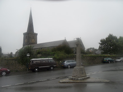
Menheniot on a wet day

I saw this old mile marker by the roadside

About Me

My photo
Exmouth, Devon, United Kingdom
Hi :) I'm a 49yo father of three from Exmouth, a lovely seaside town in Devon. In parts of Exeter I'm well known as the local milkman where I've been making traditional doorstep deliveries for 15 years.